
Explore why El Niño can weaken India’s southwest monsoon while favouring a different rainfall response in Tamil Nadu during the northeast monsoon. Understand how ocean warming, coastal currents and atmospheric circulation shape rainfall and flood risks
Syllabus areas:
GS Paper I – Geography
GS Paper III – Environment, Science & Technology, Disaster Management
Tamil Nadu’s Distinct Climatic Response
Tamil Nadu’s distinction lies in its dependence on the northeast monsoon, unlike much of India, which relies on the southwest monsoon. El Niño can weaken summer rainfall nationally while favouring stronger moisture inflow from the Bay of Bengal towards Tamil Nadu during October–December.
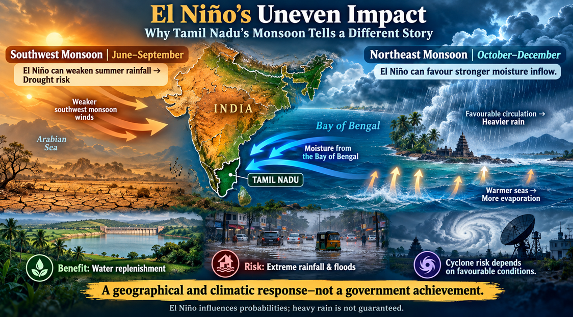
Warmer seas and favourable atmospheric circulation can intensify rainfall. This represents a regional climatic response, rather than a contribution by Tamil Nadu, offering potential water benefits alongside heightened flood and cyclone risks.
It is Tamil Nadu’s geographical location and rainfall pattern—not an achievement of its government.
Its dependence on the northeast monsoon and proximity to the Bay of Bengal mean El Niño can affect it differently from regions dependent on the southwest monsoon. However, this is not always an advantage: additional rainfall can replenish water supplies, while extreme rainfall can cause floods.
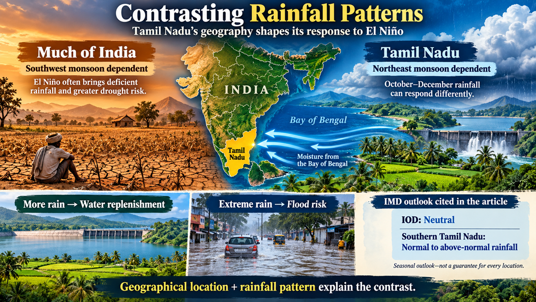
Contrasting Rainfall Patterns and the IMD Outlook
In an El Niño year, India has recorded deficient rainfall and a higher incidence of droughts, on average. However, Tamil Nadu has reported a strikingly different pattern.
Recently, the IMD’s Northeast Monsoon outlook reported a neutral IOD and forecast normal to above-normal rainfall across southern Tamil Nadu under the prevailing conditions.
El Niño and the 2015 Tamil Nadu Floods
When an El Niño shifts global wind and pressure patterns, it can supercharge the northeast monsoon over Tamil Nadu, leading to extreme rainfall and cyclones. For example, the 2015 El Niño was one of the strongest in recent decades. While India faced a weak southwest monsoon, Tamil Nadu was hit by devastating floods. Chennai recorded 1,522 mm of rain in just four days (December 1-4, 2015), more than double the normal.
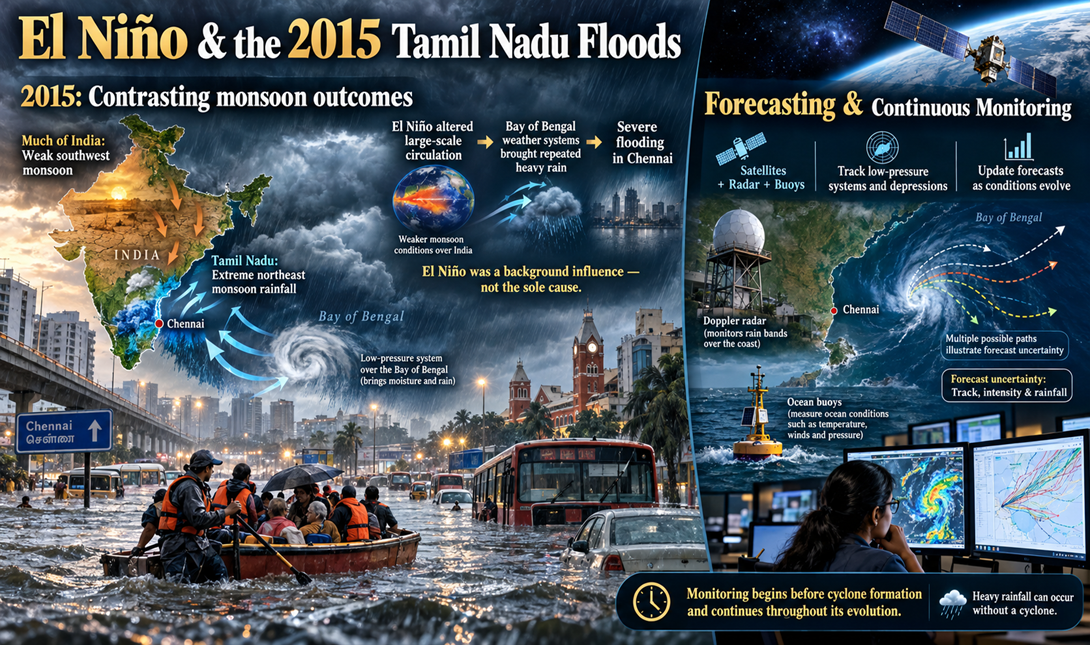
Cyclone Forecasting and Monitoring
Forecasts are updated when a depression or cyclone develops over the Bay of Bengal and close monitoring becomes essential. Because a cyclone’s formation involves nonlinear processes, it is hard to reliably predict its evolution until a cyclone has fully developed.
Possible Impact During October–December 2026
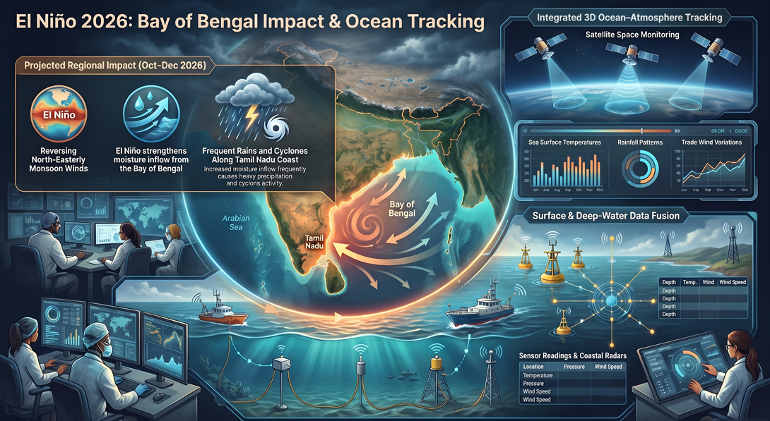
The possible impact in October to December 2026? As monsoon winds reverse into the north easterlies, the El Niño can strengthen moisture inflow from the Bay of Bengal. This has often resulted in frequent and heavy rains and cyclones along the Tamil Nadu coast.
Tracking Ocean–Atmosphere Changes
Scientists monitor the El Niño’s progress using satellites that measure sea surface temperature, rainfall, and trade winds, and combine the data with that from buoys, boats, deep-water stations and coastal radars. Together, these readings provide a 3D picture of how the ocean and the atmosphere are changing.
Role of the East India Coastal Current
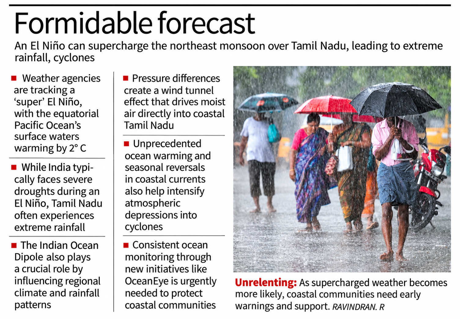
Sea currents also have a role to play. Along the Tamil Nadu coast, scientists have found that the East India Coastal Current (EICC) undergoes a seasonal reversal between February and November – a phenomenon unique to this region. Normally, equatorial currents in the western Indian Ocean flow eastwards, but in 2026, a westward flow has been observed, indicating anomalous equatorial forcing.
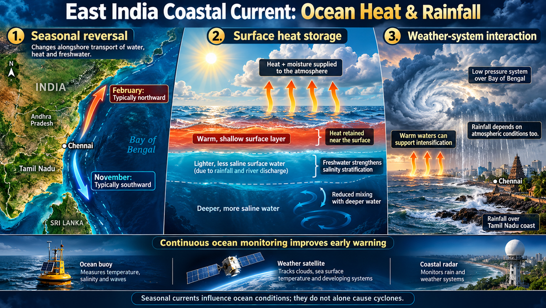
The EICC’s reversal alters alongshore transport and contributes to sea surface temperature variations. And during the northeast monsoon, these circulation shifts and ocean-atmosphere interactions may favour the development of low-pressure systems. When atmospheric depressions interact with such warm oceanic environments, the enhanced heat and moisture supply can allow them to intensify. During El Niño years, winds weaken and skies clear, allowing more sunlight to heat the ocean. In the Bay of Bengal, the shallow mixed layer and salinity stratification trap this heat, warming the waters faster. As ocean temperatures tend upward, these supercharged events are becoming more likely. If we monitor the ocean consistently, we can also spot these events early.
Why Tamil Nadu’s Rainfall Response Differs
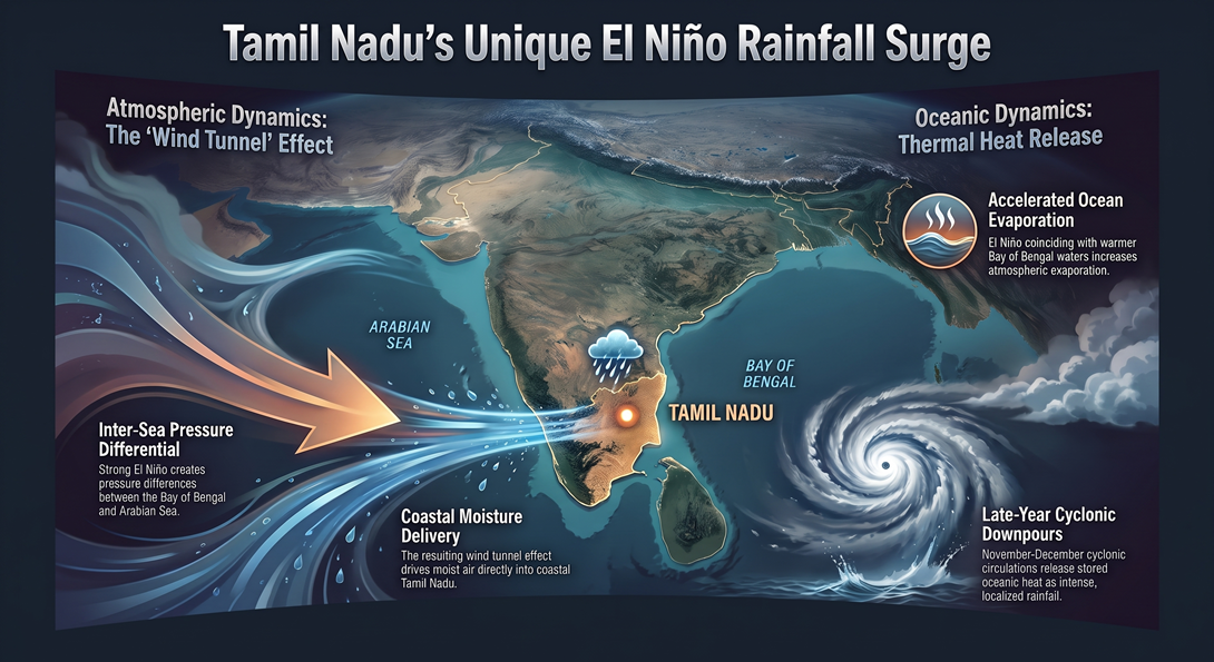
Studies have found two main reasons for this divergence. First, during strong El Niño years, pressure differences between the Bay of Bengal and the Arabian Sea create a “wind tunnel” effect that drives moist air into coastal Tamil Nadu. Second, when an El Niño coincides with warmer waters in the Bay, evaporation increases. Cyclonic circulations in November-December then release this stored heat as intense, localised rainfall.
WHAT IS ELNINO
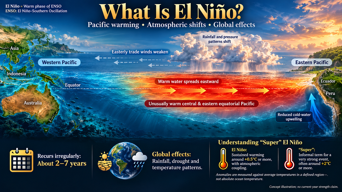
The El Niño Southern Oscillation is a climate phenomenon in the Pacific Ocean that happens every two to seven years. Its effects, however, are global.
‘Super’ El Niño
This year, weather agencies worldwide are tracking a supposed ‘super’ El Niño. It refers to surface waters of the Pacific Ocean off the western coast of Peru and Ecuador becoming warmer than average. Typically, these waters warm by about 0.5 °C, but this year the rise has reached 2 °C – a phenomenon referred to as a ‘super’ El Niño.
Indian Ocean Dipole
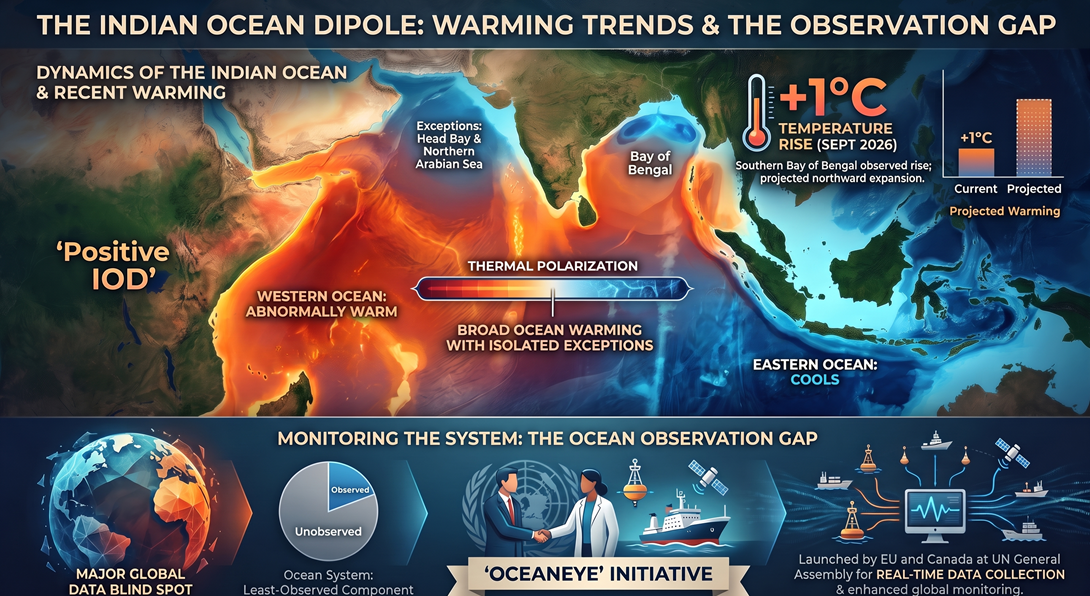
In addition to the El Niño, the Indian Ocean has its own climate driver, called the Indian Ocean dipole (IOD). The IOD is a natural phenomenon where the equatorial western Ocean experiences abnormal warming while the equatorial eastern Ocean experiences abnormal cooling.
A positive IOD occurs when the western Ocean near Africa becomes warmer than the eastern Ocean near Indonesia.
Warming Across the Indian Ocean
So far, satellite data show unusual warming in the northern Indian Ocean, especially in the southern Bay of Bengal, where sea temperatures have risen by about 1° C as of September 2026. This warming is expected to spread northwards in the coming months. Recent data also show that the entire Indian Ocean is warmer than usual. The only exceptions are the head Bay and the northern Arabian Sea.
OceanEye and the Need for Ocean Observation
Recently, the EU and Canada announced a real-time ocean data collection effort called ‘OceanEye’ at the United Nations General Assembly. More such efforts are urgently needed because the ocean remains one of the least-observed parts of the earth system.